
Basic Concepts and Component of GIS – SS1 Geography Lesson Note (Third Term)
Download this term · ₦1,000Lesson note at a glance
- Subject
- Geography
- Class
- SS1
- Term
- Third Term
- Topic
- Basic Concepts and Component of GIS
- Order
- Topic 8 of 8 this term
- Reading time
- 5 min
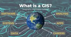
A geographic information system (GIS) is a computer-based system that captures, stores, manipulates, analyses, manages and presents spatial or geographical data. It links information to places on the Earth’s surface so that it can be shown on maps.
Behavioural objectives
- Define a geographic information system (GIS).
- State what GIS applications allow users to do.
- Distinguish between spatial data and attribute data.
- List the sources of geographic data.
- Name the five components of GIS and describe each one.
- Give examples of GIS hardware, software and uses.
What is GIS?
GIS is any information system that integrates, stores, edits, analyses, shares and displays geographic information.
- Spatial data: data that tells where something is, such as the position of a school, river or road.
- Geographic information science: the science underlying geographic concepts, applications and systems.
- Geospatial information studies: the academic discipline or career of working with geographic information systems. The letters GIS are sometimes used for this meaning too.
- Geoinformatics: the broader academic discipline in which GIS is a large domain.
What do GIS applications allow users to do?
GIS applications are tools that let users work with spatial information in four main ways.
- Create interactive queries: make user-created searches, for example, finding all schools within a local government area.
- Analyse spatial information: study patterns and relationships between places.
- Edit data in maps: add, change or delete features on a map.
- Present results: show the outcome of the operations as maps, tables or charts.
How does GIS work?
GIS works by turning information about places into data that a computer can store, process and show as a map.
- Input: data is collected and entered, for example by scanning a map or using a GPS receiver.
- Storage: the data is saved in a database on the computer.
- Analysis: the software searches, measures and compares the data to answer questions.
- Output: the results are displayed or printed as maps, tables or charts.
- Map layers: GIS keeps each theme, such as roads, rivers and settlements, as a separate layer.
- Overlay: layers are placed on top of one another so that users can see how features relate.
What are the types of geographic data?
There are two types of geographic data: spatial data and attribute data.
- Spatial data: shows the location and shape of a feature on the Earth’s surface.
- Attribute data: describes the feature at that location.
| Type | Meaning | Example |
|---|---|---|
| Spatial data | Shows the location and shape of a feature. | The position of a road or river on a map. |
| Attribute data | Describes the feature at that location. | The name, width or length of the road. |
How are spatial data represented in GIS?
Spatial data is stored in two main forms: vector and raster.
Vector data
- Meaning: features drawn as points, lines and polygons.
- Point: a single location, such as a school or a borehole.
- Line: a linear feature, such as a road or river.
- Polygon: an area, such as a lake or a local government boundary.
Raster data
- Meaning: an area divided into a grid of small square cells called pixels.
- Example: satellite images and scanned maps.
What are the sources of geographic data?
There are six common sources of geographic data.
- Satellite images: pictures of the Earth taken from space by satellites.
- Existing maps: topographic and other maps already printed or stored in digital form.
- Land survey: measurement of positions, distances and heights on the ground.
- Socio-economic statistical records: figures such as population, income and school enrolment.
- Aerial photographs: photographs taken from aircraft flying over an area.
- Fieldwork or survey: data collected directly on site by observation, measurement or questionnaires.
What are the components of GIS?
A geographic information system has five key components: hardware, software, data, people and method.
1. Hardware
- Meaning: the physical equipment used to run the GIS.
- Input devices: keyboard, mouse, scanner and GPS receiver.
- Processing and storage: the CPU and hard disk.
- Output devices: monitor and printer.
2. Software
- Meaning: the programs that carry out GIS tasks.
- Examples: ArcGIS and QGIS.
- Functions: they store, edit and analyse data, and produce maps.
3. Data
- Meaning: the geographic information put into the system.
- Importance: it is the raw material of GIS, so the results are only as good as the data.
- Sources: satellite images, maps, surveys, statistical records, aerial photographs and fieldwork.
4. People
- Meaning: the people who design and maintain the system.
- Role: they also develop plans for applying it.
- Importance: without trained people, the hardware and software cannot be used well.
5. Method
- Meaning: the plan and rules by which the GIS is operated.
- Role: a successful GIS operates according to a well-designed plan and business rules.
- Importance: it guides how data is collected, stored, analysed and presented.
What are the five components of GIS at a glance?
| Component | What it is | Example |
|---|---|---|
| Hardware | Physical equipment | Keyboard, CPU, mouse, hard disk |
| Software | Programs | ArcGIS, QGIS |
| Data | Geographic information | Satellite images, maps |
| People | Designers, maintainers and planners | GIS staff who run the system |
| Method | Plan and rules | A well-designed plan and business rules |
What are the uses of GIS?
GIS is used wherever decisions depend on location.
- Town planning: choosing sites for schools, roads and markets.
- Agriculture: mapping farmland and soil types.
- Disaster management: showing flood-prone areas so that people can be warned.
- Health: locating hospitals and mapping where diseases occur.
- Transport: planning routes and managing road networks.
Evaluation
- Define a geographic information system.
- State three things GIS applications allow users to do.
- List four sources of geographic data.
- Name the five components of GIS.
- Give three examples of GIS hardware.
Assignment
Explain the role of people and method as components of GIS.
This term's Geography topics
SS1 Third Term · 8 topics
Get Geography as PDF and Word
Every week of SS1 Geography, Third Term, formatted and ready to print. Ad-free, and the copy lock comes off.
Get this term Card, bank transfer, USSD or OPay
SS1 Geography Lesson Notes for Other Topics

Nigeria: Transportation
Read the full lesson note.

Nigeria: Communication
Read the full lesson note.

Manufacturing Industries In Nigeria
Read the full lesson note.

Nigeria: Commercial Activities
Read the full lesson note.

ECOWAS
Read the full lesson note.
Map Reading And Measurements Of Distances On Maps
Read the full lesson note.

Conventional Symbols Direction And Bearing
Read the full lesson note.

Geography: An Introduction
Read the full lesson note.

The Earth's Rotation
Read the full lesson note.

The Earth's Revolution
Read the full lesson note.

Latitude & Longitude
Read the full lesson note.

The Earth's Structure
Read the full lesson note.

Rocks
Read the full lesson note.

Mountains
Read the full lesson note.

Lowlands
Read the full lesson note.
Lesson Notes for Other Classes

SS2 Lesson Note
The complete lesson note to guide your studies.

SS3 Lesson Note
The complete lesson note to guide your studies.
